Hiking In Colorado Springs
Let’s get straight to it!
First up:
Red Rocks Canyon – Download Trail Map
For a more in depth description of the trail. Here it is! There are two main sections to the parking lot: the west half, visible when you first enter, and the east half, further along the road. Four main trails begin at the parking lots, each of which branches off into a variety of further options
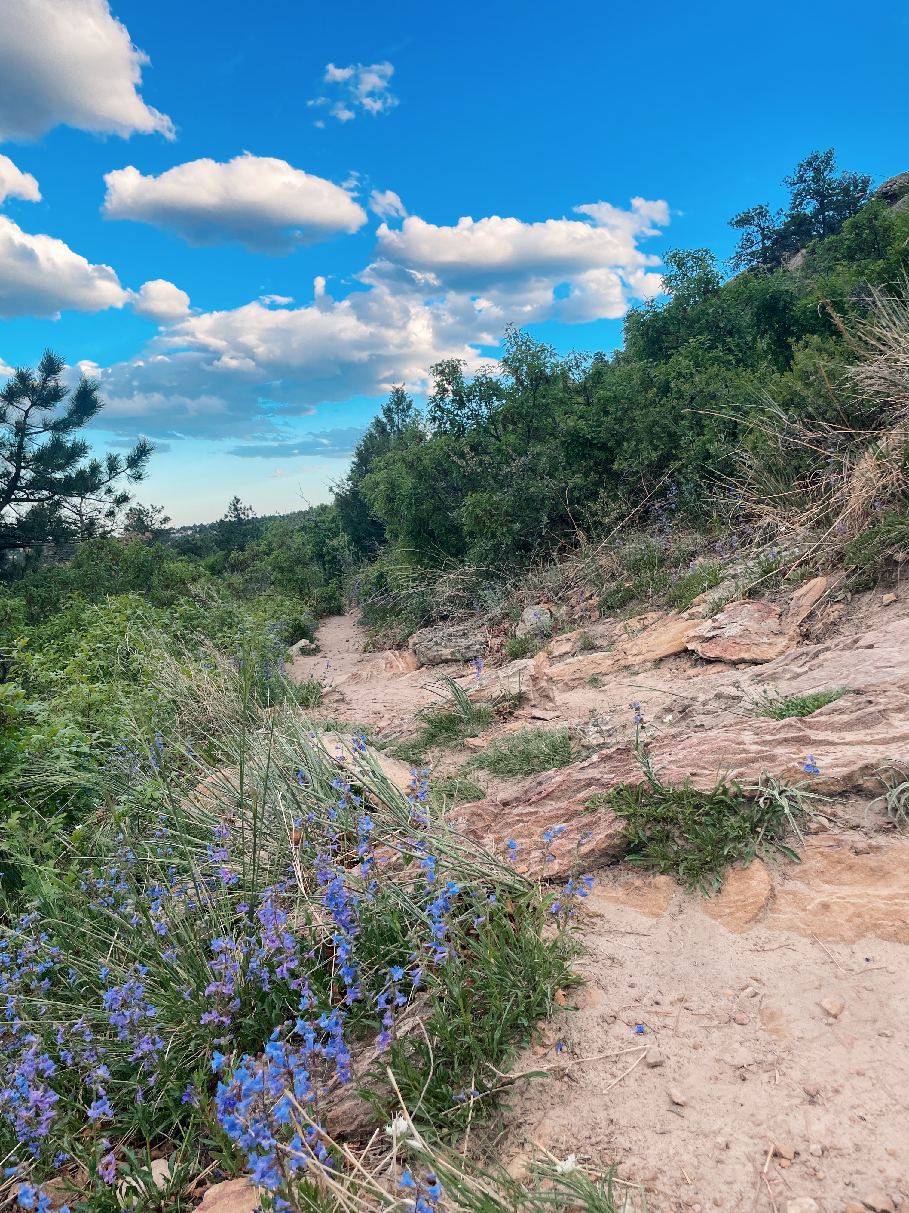
Garden of the gods:
The outstanding geological features of the park are the highly visible sedimentary rock formations. These rocks were created as ancient mountains eroded and were buried in their own sediments. Massive sand dunes moved across the land, and shallow seas and deeper oceans encroached and retreated.
Palmer Park Overlook- 3650 Maizeland Road
Fairly easy trail during the summer.
Great park in the center of Colorado Springs. Incredible views of Pikes Peak and the foothills.
Edmondson Trail: Length
2.94 mi
cottonwood creek trail: Length
13.9 mi
Generally considered a moderately challenging route, it takes an average of 4 h 46 min to complete. This trail is great for road biking, running, and walking, and it’s unlikely you’ll encounter many other people while exploring. The trail is open year-round and is beautiful to visit anytime
Pulpit Rock Park: Length
5.1 mi
It takes an average of 2 h 3 min to complete. This is a very popular area for hiking, mountain biking, and running, so you’ll likely encounter other people while exploring.
Ute Valley Parking and Hiking Trail: Length
3.7 mi
Generally considered a moderately challenging route, it takes an average of 1 h 30 min to complete.
Vindicator Trailhead: Length
2.1 mi
This is a relatively easy hike on a well-established and wide trail that loops around various old closed gold mines.
Captain Jacks Trail: Length
4.7 mi
Captain Jack’s Peak has an elevation of 8,540 ft. It is located along the Captain jack’s trail along Trail 667. In order to summit this, you will proceed off trail for about 100ft elevation gain until you climb to the top. At the top, you will enjoy a stunning view.
Columbine Trail: Length
8.0 mi- the lower trailhead located at the Starsmore Discovery Center (2120 N. Cheyenne Canyon Rd), Columbine Trail provides a variety of hiking possibilities in itself and access to several other adventures.
S Cheyenne Canyon Rd, Colorado Springs, CO 80906
Mt. Muscoco: Length
3.7 mi
Experience this 3.7-mile out-and-back trail near Colorado Springs, Colorado. Generally considered a challenging route. This is a very popular area for hiking, so you’ll likely encounter other people while exploring.
Inspiration Point: Length
3.0 mi
Visitors staying at the Broadmoor can take a free shuttle to the Seven Falls. For those not staying there, there is a shuttle available from the Norris Penrose event center off lower Gold Camp Road.
Seven Bridges Trail: Length
3.5 mi
Located just west of Colorado Springs, the Seven Bridges Trail is a very popular route along North Cheyenne Creek. The trail gets its name from the seven small bridges hikers traverse while meandering along the creek.
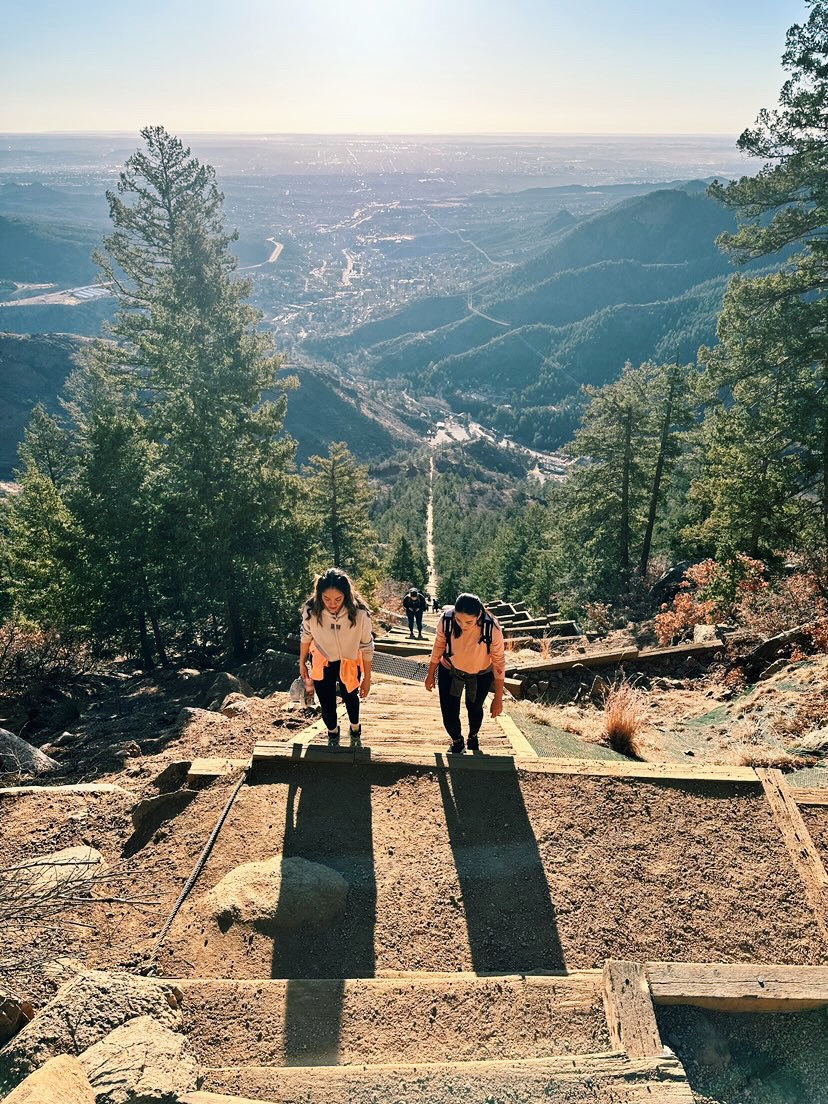
The Incline
This is a must-hike in Colorado Springs. Located in the Manitou area. I love to come here then go for lunch or a coffee after and walk around the town.
Length
4.0 mi: Feels longer

Hiking Backpack
The hydration pack backpack is the perfect companion. The front straps are not very adjustable it’s the sides you get the adjustment in. There is a ton of accessible storage in the front panels and straps, making it ideal to carry your phone, and sunblock, snacks.
Stay hydrated my friends

Publisher